Multi-Tenant Onboarding & Fleet Yard Setup
Every municipality, WSSC, or private contractor receives an isolated operational workspace. Administrators configure operational yards, dispatch depots, and assign field supervisors and drivers with cryptographic role permissions.
- 60-Second Self-Registration
- Multiple Depots & Branch Offices
- Staff & Driver Shift Rosters
Tenant Provisioning
Central Management ConsoleGIS Asset Mapping & Bin Cluster Registry
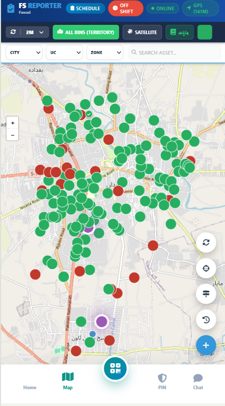
Waste bins, communal containers, and dumping points are geo-tagged with coordinates, capacities, and collection priorities. PostGIS algorithms cluster stops to eliminate overlapping vehicle mileage.
- Sub-Meter Precision GPS Coordinates
- RFID & QR Tag Integration
- Need-Based Fill Level Telemetry
Spatial Geo-Tagging
PostGIS Spatial EngineAutomated Schedule & Turn-by-Turn Route Compilation
Daily mission queues are automatically compiled based on operational shifts. Routes are ordered into optimal sequential stop sequences, taking into account vehicle capacity and road network travel times.
- Multi-Stop Traveling Salesman Optimization
- Automated Shift Queue Generation
- Emergency & Ad-Hoc Task Insertion
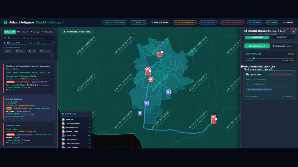
Dispatch Intelligence
Automated Route BuilderOffline-First Mobile Driver Execution
Drivers receive their daily mission on any low-end smartphone. High-contrast turn-by-turn navigation with audio prompts guides them from stop to stop. Collection proof is verified via mandatory camera photos, working seamlessly offline.
- 100% Offline IndexedDB Data Vault
- Audio Turn Prompts in Local Dialects
- Camera Proof of Collection
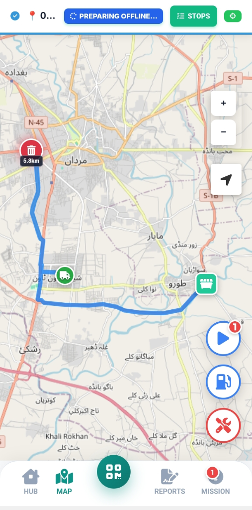
Real-Time Supervisor Command & Breadcrumb Playback
Field supervisors monitor live GPS telemetry on tactical maps. The system automatically detects vehicle idling, route deviations, speed violations, and calculates fuel efficiency against actual road mileage.
- Sub-Second Live Breadcrumb Tracking
- Fuel Theft & Idling Dwell Alerts
- Supervisor Street Sweep Verification
Citizen Grievances & Verified Proof-of-Work
Citizens report waste overflows or water issues with zero login through geo-tagged photos. When staff resolves the issue, mandatory after-photos are uploaded, generating a transparent audit log and SMS/public tracking verification.
- Zero-Login Camera Photo Submissions
- Automatic Geo-Fenced Ward Routing
- Before & After Photo Verification
Public Civic Accountability
Citizen Resolution PortalWho Operates the System?
MyMaan provides role-optimized consoles tailored to each tier of your operational chain of command.
Tenant Administrator
Manages company-wide parameters, depots, fleet registrations, fuel budgets, billing, and executive analytics.
Field Supervisor
Monitors live routes, handles unscheduled ad-hoc complaints, approves driver shift attendance, and audits collection stops.
Vehicle Driver
Follows audio turn-by-turn routes on their smartphone, records proof photos, and reports blocked roads or container overflows.
Public Citizen
Reports cleanliness issues with photo pinpoints and tracks resolution progress in real time without creating an account.
Ready to Modernize Your Operations?
Deploy the full MyMaan intelligence stack in your municipality or corporate fleet with instant 30-day self-onboarding.